
A Flame Length Probability File (FLP) is a gridded text file that contains information about burn probability and fire intensity for each point. Fire intensity is expressed as Fire Intensity Level (FIL) classes. Each FIL is related to flame length classes (they differ for Metric and English FLPs, more below). The sum value of the FIL categories is 1, where the value within each FIL is the probability of the fire burning at that intensity.The FLP file is also referred to as the conditional flame intensity file, because it includes information on the intensity of any point on the landscape, given a fire occurs.

Example of converted FLP shapefile attributes table (A) and shapefile (B) for an FLP with 20 FILs.
Conditional flame length (CFL) is the probability-weighted flame length given a fire occurs, and is a measure of wildfire hazard. It can be calculated during the conversion of the FLP file(s). The formula to calculate CFL is:
CFL = ∑ (BPi) (Fi)
where BPi is the probability of a fire at the ith flame length category (the FIL value) and Fi is the flame length midpoint of the ith FIL category (i.e., for the 20 bin Metric FLP 0.25 m, 0.75 m, etc.).
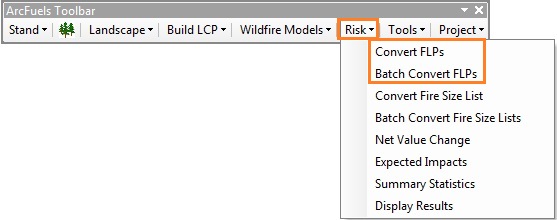
The Convert FLPs form combines multiple ArcGIS steps into one:

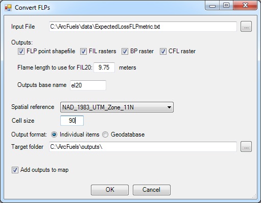
Input File is the FLP text file to be converted.
Outputs:
The Batch Convert FLPs form has the same functionality as the Convert FLPs form with the added benefit of converting multiple files at once.
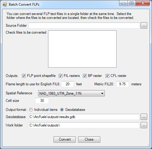
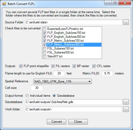
The Source Folder is the path to the FLPs to be converted.
In this exercise, you will convert a single FLP file output from FlamMap5, into a projected point shapefile. The FLP is from a run completed at 90 m resolution for the entire Mt. Emily landscape.
Click the Risk button on the ArcFuels10 toolbar, then select Convert FLPs from the drop-down list.
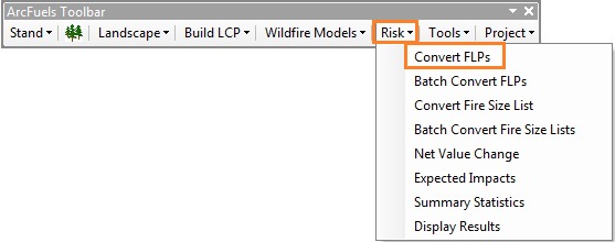
Fill out the Convert FLP form following the figure below.
Return to ArcMap.
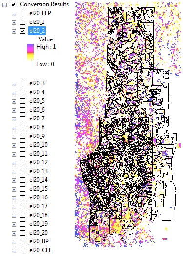
Converted files from the FLP for the Mt. Emily project area. The raster displayed is the FIL2 which represents the probability (0 to 1) of a flame length between 0.5 and 1.0 m (1.6 to 3.3 ft).
In this exercise, you will convert multiple FLP files output from FlamMap5 from two MTT random ignition (150 and 300) runs for a sub area of the Mt. Emily landscape.
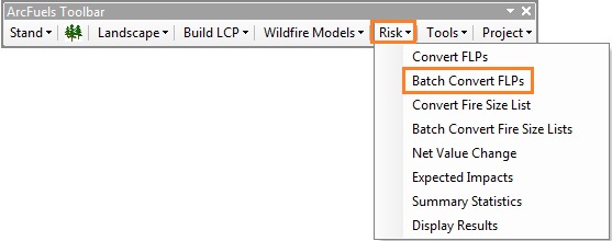
Click the Risk button on the ArcFuels10 toolbar, then select Batch Convert FLPs from the drop-down list.
Fill out the Batch Convert FLPs form following the figure below.
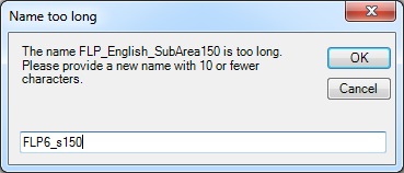

Return to ArcMap.
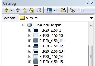
Geodatabase of batch converted FLP data for a sub area within Mt. Emily for both English FLP6 and Metric FLP20 file types.
If you try to convert an already converted file, you will get a series of error windows and warnings. 
To continue to the next section go to Convert Fire Size List.