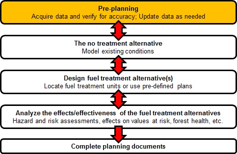

Pre-planning includes gathering all the data and information necessary to start an assessment. Data used to build the landscape files for fire behavior modeling can be either all raster data (i.e., LANDFIRE or GNN) or raster data for topography (elevation, slope, aspect) and FVS ready data for fuels (canopy cover, canopy base height, canopy height, canopy bulk density and fuel model) or a combination of the two. Other data about highly valued resources and assets, infrastructure, treatment objectives, treatment project outline, stands, etc. should also be obtained at this time. Because no tools specific to data acquisition are within ArcFuels10, this will not be covered here, but Running ArcFuels10 with Your Data has more information about data sources.
Once the data is gathered it is recommended that the data be checked for accuracy and updated as necessary. For the following scenario the supplied LANDFIRE data will be used. ArcFuels10 contains a number of tools that can be used to both check data and update it as necessary.
If not already added to your ArcMap session, add the Demonstration Data and set up your project Setting up ArcFuels10 with the Mt. Emily Demonstration Data.
The supplied LANDFIRE data is the 2008 Refresh data and reflects vegetation changes and disturbances through 2008. Since 2008 one wildland fire has occurred within the project area. The fire burned about 250 acres and was primarily a low intensity surface fire.
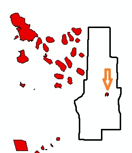
Recent fire history pointing our the fire within the Mt. Emily landscape.
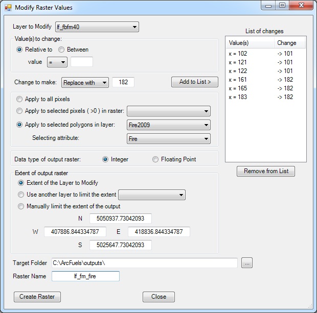
After some field monitoring it was found that the fire only impacted the fuel model selection and canopy base height within the perimeter. It was determined that all grass (GR) and grass/shrub (GS) fuel models are now GS1 (101), and all timber based fuel models (TU, TL) are now TL2 (182). No slash blow down (SB) or shrub (SH) fuel models were present before the fire. Before the fire canopy base height ranged from 0 to 1.8 m and after the fire a canopy base height (CBH) of 3 m best represents all areas where CBH existed (> 0 m), otherwise it was unchanged.
Click the Tools button on the ArcFuels10 toolbar then select Modify Raster Values from the drop-down list. For details about the form please see Modify Raster Values.

Fill out the Modify Raster Values form following the figure below.
Return to ArcMap.
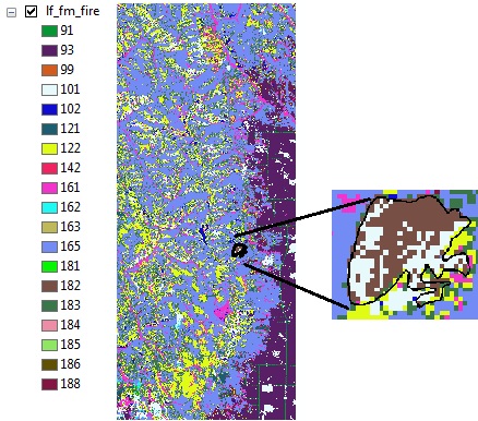
Next, the canopy base height will be updated. This could have been done with the form still open after modifying the fuel models.
Re-open the Modify Raster Values form and fill it out following the figure below.
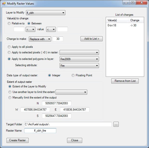
Return to ArcMap.
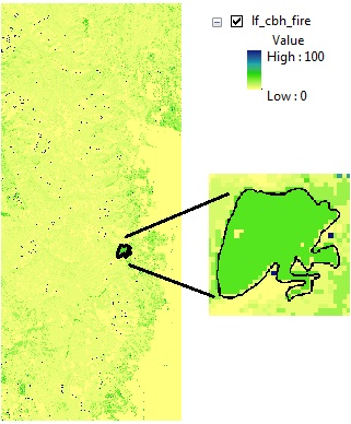
For more complex updates, the Build LCP: Using Raster Data form, Apply Treatment Adjustments options can be used. This form was demonstrated in the ArcFuels10 Toolbar section in Exercise 20 and Exercise 21.
To continue to the next section go to The no-treatment alternative.