

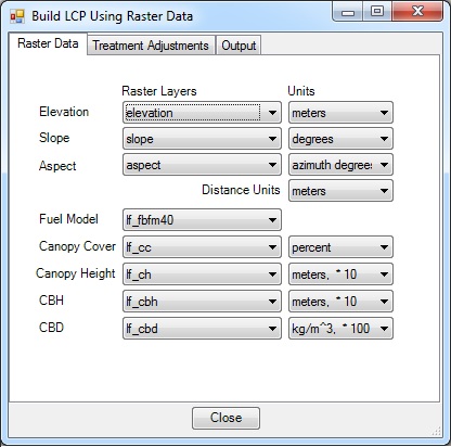
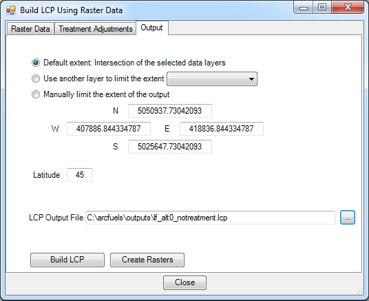
The Build LCP Using Raster Data form builds LCPs and/or rasters from ArcGIS rasters. This eliminates the need to export the rasters as ASCII files, which is required for creating LCPs in FlamMap and FARSITE. A common source of raster data for landscape-level fire modeling is LANDFIRE; however, it is also possible to use other sources such as locally derived data. The Build LCP Using Raster Data form consists of three tabs, Raster Data , Treatment Adjustmentsand Output. The Outputs tab and Create Rasters form are the same as the Build LCP using FVS or GNN Data form and will not be described again, please refer to Build LCP: Using FVS or GNN Data for details.
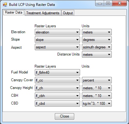
The Raster Data tab is where the raster sources and units are selected using the drop-down lists. Data must be loaded in your ArcMap session to be available.
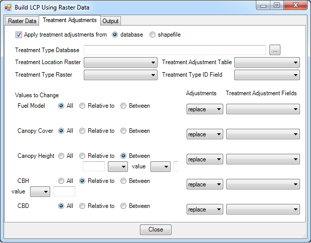
The Treatment Adjustments tab is where treatments can be rapidly applied using a treatment adjustments database (top) or an attributed shapefile (bottom). There are two options for applying treatments, from a database or shapefile.
Determining what to replace or how to adjust rasters can be determined by running FVS/FFE-FVS through ArcFuels or independently. FVS/FFE-FVS can also predict fuel models under changed stand conditions. However, expert knowledge of the on-the-ground conditions should be used in conjunction with these data. Note that shrub dynamics are not a part of FVS; fuel models are predicted based on the data collected by standard forest inventory plots. Alternatively, adjustments can be derived from monitoring data of treated areas that represent the post-treatment conditions desired, or may come from a specific treatment prescription (i.e. canopy cover will be reduced to 40% and canopy base height will be lifted to 6 ft).
When using the Apply treatment adjustments from a database option the treatment database is coupled with rasters location and type of treatment. Multiple treatment alternatives can be maintained in a single treatment adjustments database where the Treatment Type ID Field is linked to multiple Treatment Type Raster(s) created for each alternative.
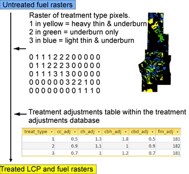
This is a convenient way to build and archive different treatment alternatives. All of the alternatives can be maintained in a single treatment adjustments database where the Treatment Type ID Field is linked to multiple Treatment Type Raster(s) created for each alternative. Treatment adjustments can either be multiplication factors (i.e. 0.2 would reduce input data by 80%) or replacement factors (i.e., 2 m for canopy base height).
The treatment database is spatially linked via two rasters.
When creating your own treatment adjustment database, copy and paste the example data. The field types are important for ArcFuels10 functionality.
When using the Apply treatment adjustments from a shapefile option the treatment shapefile includes the treatment adjustments and a 0/1 field indicating if the adjustments should be applied to a specific polygon.
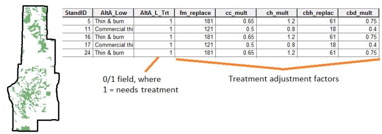
The green stands are marked with a 1 in the shapefile indicating they need treatment. Then the treatment adjustment factors are used to apply the treatments to each polygon.
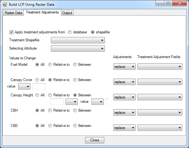
The treatment adjustments are applied using an attributed shapefile.
An LCP file from the supplied LANDFIRE raster data will be created in this exercise. Because the rasters have not been modified, they will not be re- created.
Click the Build LCP button on the ArcFuels10 toolbar, then select Build LCP Using Raster Data from the drop-down list.

Select the Raster Data tab, fill out the form following the figure below.
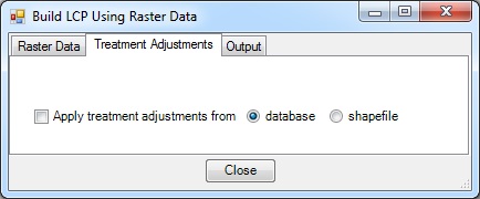
Select the Treatment Adjustments tab.
Select the Output tab, fill out the form following the figure below.

If you would like to save your raster layer settings , re-export the project settings. See Project: Export Settings if you are unsure how.
In this exercise raster values will be adjusted to apply a treatment alternative using location and treatment type rasters and a treatment adjustments database to build an LCP file and rasters. The supplied LANDFIRE raster data will be used as the input. When this option is selected treatments can be rapidly applied using a treatment adjustments table in the (Mt_Emily_Database.mdb) coupled with rasters indicating location (trt_location) and type (trt_type) of treatment.
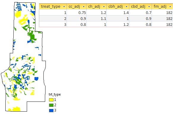
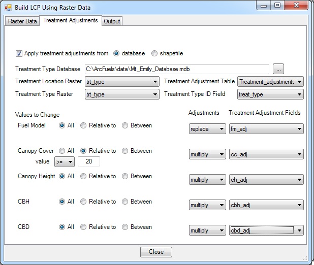
In the example database, multiplication adjustments are used for altering canopy characteristics. For example, treatment type 1 reduces canopy cover (cc_adj) by 25% (multiplies the existing condition by 0.75), reduces canopy bulk density (cbd_adj) by 30%, and increases canopy height (ch_adj) and canopy base height (cbh_adj) by 20% and 40%, respectively. The fuel model (fm_adj) will be replaced with 182. The canopy cover adjustments are only applied where it is greater than 20% pre-treatment.
Click the Build LCP button on the ArcFuels10 toolbar, then select Build LCP Using Raster Data from the drop-down list.

Select the Raster Data tab, fill out the form following the figure below.

Select the Treatment Adjustments tab, fill out the form following the figure below.
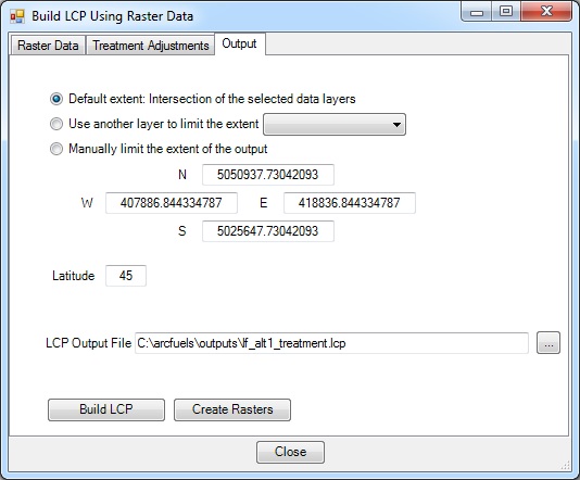
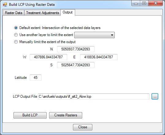
Select the Output tab, fill out the form following the figure below.
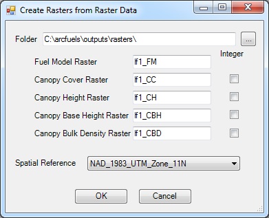
Return to ArcMap.
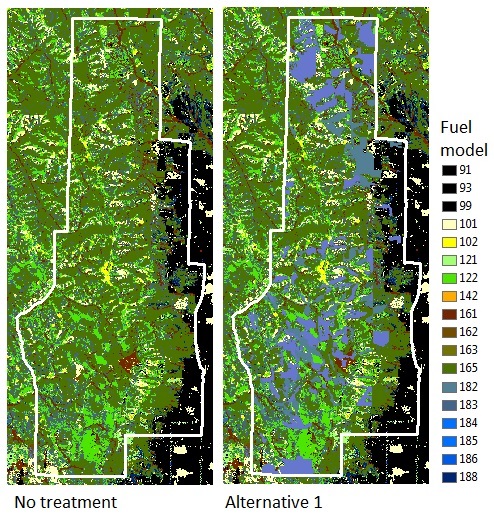
Maps of the fuel model raster in the no treatment and alternative 1. Notice the changes to fuel model 182 after treatment.
In this exercise raster values will be adjusted to apply a treatment alternative using an attributed shapefile to build an LCP file and rasters. The supplied LANDFIRE raster data will be used as the input.
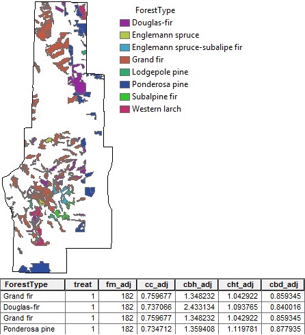
The shapefile can contain multiple treatment alternatives; however there must be a unique attribute of 0s and 1s for each alternative, where the 1 indicates the polygon is to be treated (i.e., treat in the figure above). In addition, treatment adjustments (multiplication factors or replacement values) for the fuel model, canopy cover, canopy height, canopy base height, and canopy bulk density layers must be included.
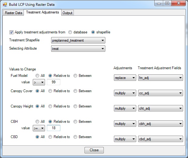
The demonstration data includes a treatment shapefile (preplanned_treatment) that contains different treatment adjustments based on forest type. The values were derived FVS/FFE-FVS runs.
Click the Build LCP button on the ArcFuels10 toolbar, then select Build LCP Using Raster Data from the drop-down list.

Select the Raster Data tab, fill out the form following the figure below.

Select the Treatment Adjustments tab, fill out the form following the figure below.
Select the Output tab, fill out the form following the figure below.
To continue to the next section go to Build LCP Using Shapefile Data.