

The Build LCP Using FVS or GNN Data form builds LCPs and/or rasters from FVS or GNN (Ohmann and Gregory 2002) output database(s) that are spatially linked via a raster that ties the FVS stand-identification numbers to their spatial location on the landscape. This is a raster version of the stand shapefile.
To use this function, FVS/FFE-FVS must be run first for all unique stands within the landscape. It is possible to have FVS data from one stand be applied to multiple stands in the landscape, as is common with GNN and MSN data. Because FVS/FFE-FVS reports only the fuel model and canopy characteristic layers (canopy cover, canopy height, canopy base height (CBH), and canopy bulk density (CBD)), topographic rasters (elevation, slope, aspect) must be obtained and loaded into the ArcMap table of contents to use this tool.
The Build LCP Using FVS or GNN Data form consists of two tabs, FVS Data and Output.
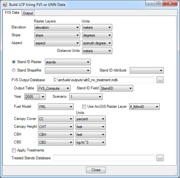
The FVS Data tab is where the data sources are specified (topographic rasters, FFE-FVS output database(s), and related data table and data fields).
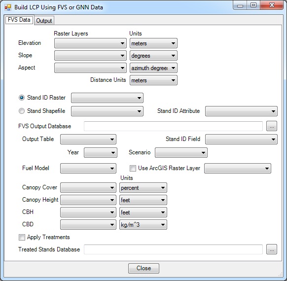
Topographic rasters are needed to build a LCP from FVS data because that information is not part of an FVS/FFE-FVS run. Rasters are needed for Elevation, Slope, and Aspect and the units need to be defined for each. Because you are inputting raster data, the program needs to know what the Distance Units are; this is most often meters. The created LCP will be the same resolution as the topographic rasters.The rasters must be loaded in your ArcMap session to be available.
An existing FVS/FFE-FVS output database is used to populate the fuel model and canopy characteristics within the LCP.
When the Apply Treatments option is selected, two FVS/FFE-FVS databases can be combined to build the LCP and rasters. ArcFuels10 replaces data from the FVS Output Database (typically a no-treatment run with all stands represented) with that from the Treated Stands Database for all stands present. This is often used when running FVS for selected stands with prescriptions, rather than running the entire landscape as a time-saving step, see Exercise 12 as an example.
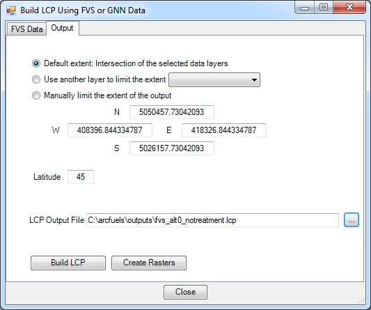
The Output tab is where the desired extent of the output LCP and/or rasters is specified, as well as the path and name of the output LCP.
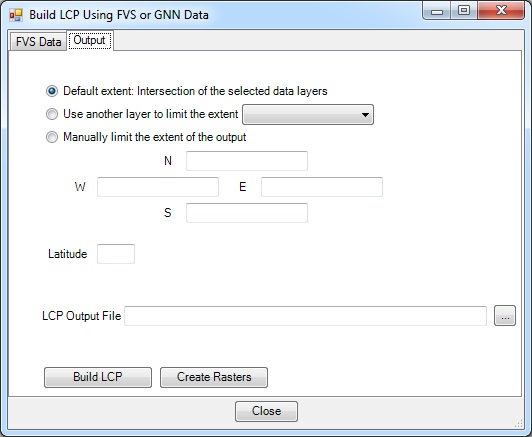
There are three options for the extent of the LCP and/or rasters that are created:
The LCP Output File path and name are specified . The default path is the output folder specified when setting up a project in the Project Settings form.
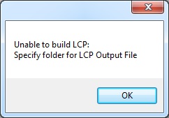
If you just type a name in the text box rather than using the navigation button, ArcFuels10 will not build the LCP .
The Create Rasters button will open a new form, where the non-topographic rasters are named and the spatial reference is defined. Building rasters for the layers from FVS can be helpful for further analysis.
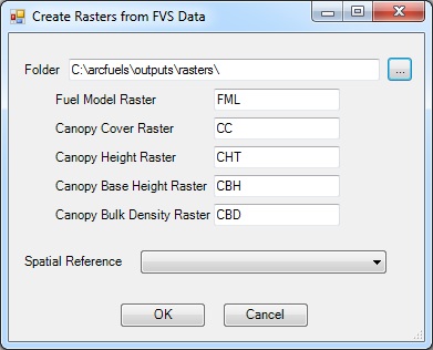
Normal raster naming protocols are needed when creating rasters with this form. If they are not applied the rasters will not be created.

In this exercise, a LCP file and rasters will be created from an FVS/FFE-FVS run that included all stands in the Mt. Emily area. This will use the no treatment alternative FVS/FFE-FVS output database from Exercise 11.
Because FVS/FFE-FVS does not output topographic data, LANDFIRE elevation, slope, and aspect rasters will be used to build the LCP. These rasters need to be added to the ArcMap table of contents to be available.
Click the Build LCP button on the ArcFuels10 toolbar, then select Build LCP Using FVS or GNN Data from the drop-down list.

Select the FVS Inputs tab, fill out the form following the figure below.
Select the FVS Outputs tab, fill out the form following the figure below.

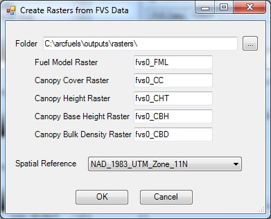
Return to ArcMap.
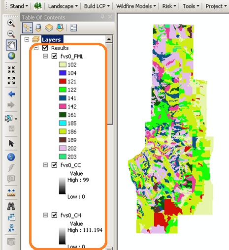
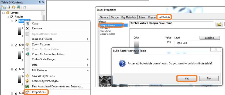
If you can't open the attribute table you might have to build it via the Properties menu option.
An LCP file and rasters will be created from two FVS/FFE-FVS runs. The first is the no treatment alternative, that included all stands. This will use the no treatment alternative FVS/FFE-FVS output database from Exercise 11. The second only ran stands with prescriptions, and is a partial database. This will use the alt1_ideal.mdb database created in Exercise 12.
Click the Build LCP button on the ArcFuels10 toolbar, then select Build LCP Using FVS or GNN Data from the drop-down list.

Select the FVS Inputs tab, fill out the form following the figure below.
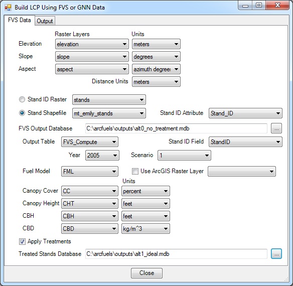
Select the FVS Outputs tab, fill out the form following the figure below.
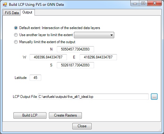
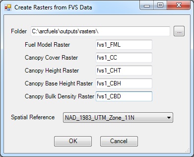
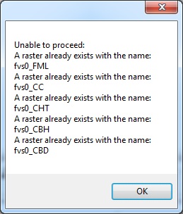
If rasters already exist with the names specified in any of the Create Rasters from, an error window will open indicating which raster names already exist. You will need to reopen the form and rename the rasters to be able to create them .
Return to ArcMap.
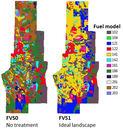
Fuel model maps of the no treatment and ideal treatment alternatives derived from FVS data.
To continue to the next section go to Build LCP Using Raster Data.