

The Build LCP Using Shapefile Data form builds LCPs and/or rasters from attributes within a shapefile. As with the Build LCP Using FVS Data form, topographic rasters (elevation, slope, aspect) must be obtained and loaded into the ArcMap table of contents to use this form.
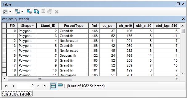
Attributes from a shapefile with data for the surface fuel model (fml) and canopy characteristics (cc_per, ch_m10, cbh_m10, cbd_kgm3100) needed to build a LCP.
The Build LCP Using Shapefile Data form consists of two tabs, Shapefile Data and Output. The Outputs tab and Create Rasters form are the same as the Build LCP using FVS or GNN Data form and will not be described again, please refer to Build LCP: Using FVS or GNN Data for details.
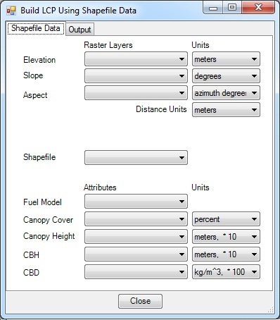
The Shapefile Data tab is where the input data is specified. Raster data is needed to define the topography and must be loaded into ArcMap to be available. The surface fuel model and canopy characteristic are selected from attributes within the specified stand shapefile.
A LCP and rasters will be built from an attributed shapefile in this exercise. This will use the mt_emily_shands.shp shapefile, which has the majority fuel model from LANDFIRE, and the average canopy cover, canopy height, canopy base height, and canopy bulk density from LANDFIRE data.
Like building the LCP from FVS data, topographic rasters are needed. Again, the LANDFIRE elevation, slope, and aspect rasters will be used.
Click the Build LCP button on the ArcFuels10 toolbar, then select Build LCP using Shapefile Data from the drop-down list.

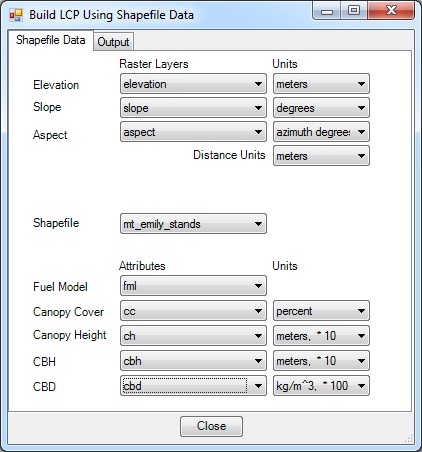
Select the Shapefile Data tab, fill out the form following the figure below.
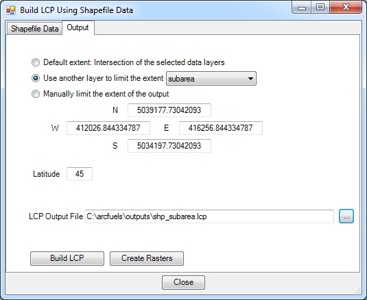
Select the Output tab, fill out the form following the figure below.
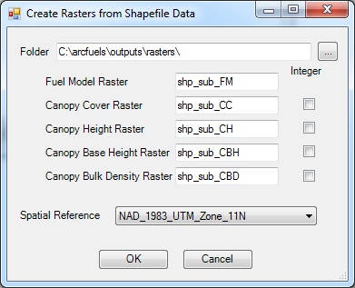
Return to ArcMap.
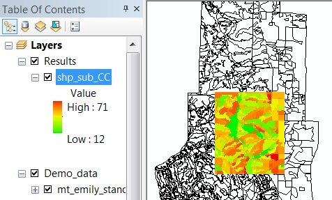
Notice the new rasters are a much smaller extent than the Mt. Emily landscape.
To continue to the next section go to Build LCP by Merging Data.