

Building an LCP from multiple raster sources within ArcFuels10 is a time saving tool that allows you to mosaic multiple raster layers together, and create an LCP in a single step. This tool might be used if you have smaller extent raster layers that represent updated conditions due to recent management or disturbance. Or, when creating landscape files for fire behavior simulations, it is preferred to have a rectangular extent. And, often stand inventory data is not rectangular in extent, so this tool is a quick way to mosaic in LANDFIRE (or other raster data) to make the LCP rectangular.
The Build LCP by Merging Data form allows the user to mix and match rasters from varying data sources (e.g., LANDFIRE, FFE-FVS, GNN, local, or LiDAR) or mosaic together multiple rasters of different spatial extents into one seamless layer for any given data set needed to create an LCP. It is even possible for the rasters to have different units, but they must be the same resolution and projection, and be snapped (aligned).
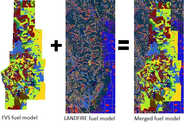
The Build LCP by Merging Data form mosaics multiple rasters with different spatial extents together to build a LCP.
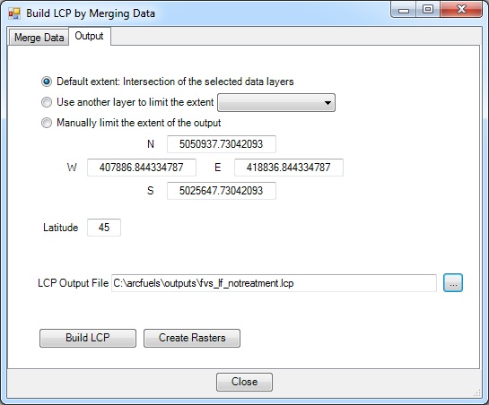
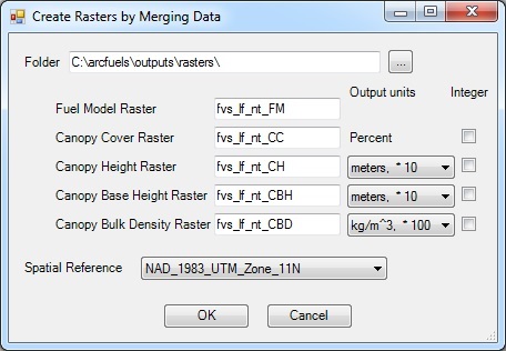
The Build LCP by Merging Data form consists of two tabs, Merge Data and Output. The Outputs tab and Create Rasters form are the same as the Build LCP using FVS or GNN Data form and will not be described again, please refer to Build LCP: Using FVS or GNN Data for details.
In the Merge Data tab, the various rasters that will be merged are selected.
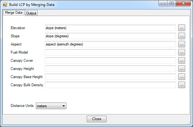
The navigation button  to the right of each required data opens a new form where the rasters can be selected and the units defined.
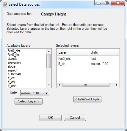
There is no limit to the number of rasters used in this form. However, they must all be the same resolution, projection and be snapped. They can be different extents, and have different units. The default LCP creation units are those of LANDFIRE if they are of a mixed source. The order of the rasters in the form dictates the merge, raster on the top of the list overwrite those below.
In this exercise you will be building a no treatment LCP and rasters, using the “fvs0_” rasters created in Exercise 11 (FVS/FFE-FVS run to create the database) and Exercise 17 (using ArcFuels to create rasters from the FVS/FFE-FVS database) and the supplied LANDFIRE rasters.
If not already added to ArcMap, add the "fvs0_"rasters.
Click the Build LCP button on the ArcFuels10 toolbar. Then select Build LCP by Merging Data from the drop-down list.

Select the Merge Data tab, fill out the form following the figure below.
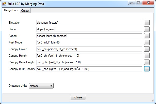
 select all the rasters and units seen above.
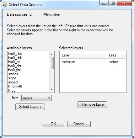
If you selected the incorrect layer or units, highlight it under the Selected layers portion and click the <Remove Layer button to remove it.
Select the Output tab, fill out the form following the figure below.
Return to ArcMap.
To continue to the next section go to Wildfire Models.