

The Join FVS Outputs form joins FVS/FFE-FVS outputs from any table in the output database for a given year to the stand shapefile layer. Because FVS runs often include multiple simulation years, it is not possible to join the outputs to the stand shapefile using ArcMap. The Join FVS Outputs form allows you to join data from any year within a FVS output table. This is quite helpful for visualizing the FVS/FFE-FVS runs on the landscape.
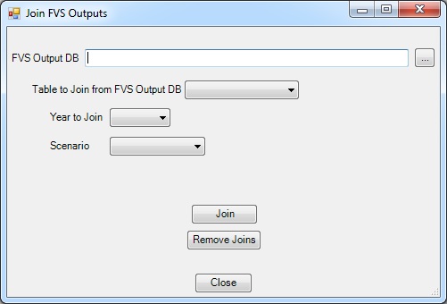
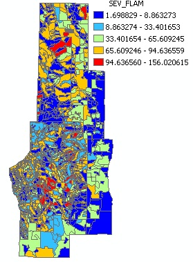
A sample map created after joining the FVS_Compute table with severe flame length (ft) outputs for 2005 from a landscape FFE-FVS run to the stand shapefile for the supplied ArcFuels demonstration area.
You have completed FVS runs for the existing conditions across your landscape. And you want to be able to highlight areas on a map that might have high levels of stocking to target for thinning operations for hazardous fuels reductions. You will use the TPA (trees per acre) output from FVS.
The no treatment database was created in Exercise 11 if you have not completed that exercise, please do so now.
Click the Landscape button on the ArcFuels10 toolbar, then select Join FVS Outputs from the drop-down list.

Fill out the Join FVS Values form following the figure below.
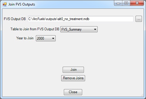

If you have the attributes table open the function will not work. Close the attributes table and try again. 
Return to ArcMap.
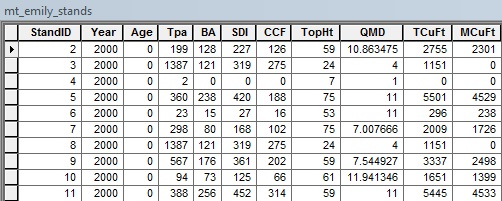
To visualize the FVS calculated tree density (TPA), change the symbology.
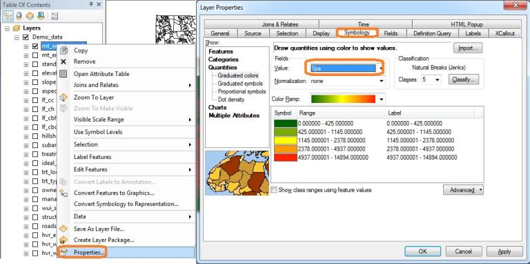
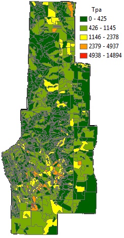
Look at the map. Now you can see where the areas are with the highest tree density (red) and the areas of lowest density (green).
It is not possible to do multiple joins at once using this tool. The most recent join will replace any past joins, even if the Remove Joins button is not used.
Joins can be removed using the Join FVS Outputs form (ArcFuels Toolbar > Landscape > Join FVS Outputs) with the Remove Joins button.Joins can also be removed in ArcMap.
It is possible to output all the original and joined attributes to an Excel workbook for additional analysis (see Export Shapefile Attributes to learn how).
To continue to the next section go to Landscape Treatment Designer (LTD).