Airborne and Lidar Experiments for the Evaluation of Smoke Transport Models
Wildfires are a significant source of airborne pollutants. Smoke from wildfires has significant negative impacts on public health including increased physician visits, emergency room visits, hospital admissions, and mortality. Air quality regulators and land managers employ smoke modeling systems to predict, evaluate, and manage the impacts of fire emissions on air quality. Accurately describing and predicting the dynamics of smoke plumes and subsequent smoke transport is a major uncertainty in determining the impact of wildfire emissions on air quality. While many smoke transport models exist, few observational datasets are available to properly validate these models and quantitatively assess their uncertainties, biases, and application limits. This project was conducted to address these critical gaps in observations.
The project, co-funded by the Joint Fire Sciences Program (Project #08-1-6-09), and U.S. Forest Service Research and Development, installed smoke chemistry measurement instruments on a U.S. Forest Service Cessna aircraft. Using the Cessna as a platform, fresh emissions, plume height, and smoke dispersion were measured from 12 wildland fires, over 23 days, in the western U.S. For some of the fires studied, a ground-based mobile lidar measured plume height and plume physical dimensions. The project dataset, which includes a comprehensive data document, has been published in the U.S. Forest Service Reseach Data Archive. The emission measurements found that wildfires in the interior mountain west burned with much lower combustion efficiency than previously assumed. Thus, for a given mass of vegetation burned, wildfires emit more fine particulate matter, and more non-methane organic compounds than previously thought, which leads to increased levels of ground-level ozone. This can negatively impact human health, as well as terrestrial ecosystems.
The project provides air quality and smoke dispersion model developers with a unique dataset that is needed to quantitatively evaluate and improve plume rise models and high-resolution smoke dispersion and air quality forecasting models. The emission results indicate that previous estimates of wildfire emissions may underestimate the production of pollutants and the potential of wildfires to degrade local and regional air quality. This research will enhance the ability of land managers and air quality regulators to mitigate the effects of wildfires on human health, economic activity, and aesthetic integrity.
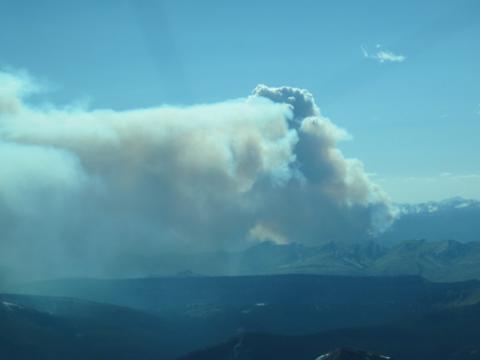
Photo: Smoke plume from the Big Salmon Lake Fire sampled on August 17, 2011.
