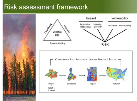
A quantitative wildfire risk assessment is underway for the sagebrush biome in the western US to inform investments in hazardous fuel treatments, including those intended to protect sage-grouse habitat.
Within the Great Basin alone, hundreds of thousands of acres of highly imperiled sagebrush ecosystems are lost or degraded each year as a result of altered wildfire regimes. In response to these wildfire threats, extensive systems of linear fuel breaks are being constructed, enhanced, or proposed throughout the region. The quantification and display of wildfire risk are critical for ensuring that cost-effective investments are made as this fuel break network is maintained and expanded, and as other fuel-reduction activities are considered. To characterize wildfire hazard, burn probability and conditional fire intensity datasets have been created at multiple spatial scales using the Forest Service’s Fire Simulation, or FSim, system. This research project includes a customized regional modeling effort for the sagebrush biome, including the burn probabilities and simulated fire perimeters, which can be overlaid with areas of conservation concern, like core sagebrush habitat or growth opportunity areas with special consideration of resilience to disturbance and resistance to invasion by exotic plants (e.g., cheatgrass). Initial assessments indicate that risk is not uniform across the landscape and suggest that strategic investments considering both in situ and transmitted risk will be most cost effective. Strategic placement of fuel breaks, for example, is expected to realize a large proportion of total possible risk reduction at relatively low investment levels. These initial findings are similar to those recently published by other FS researchers, and demonstrate how state-of-the-art datasets and analytics, including FSim outputs, can be used to help prioritize fuel treatment investments within focal landscapes.
Related Projects:
FSIM Wildfire Risk Simulation Software
ForSys Scenario Planning Model
