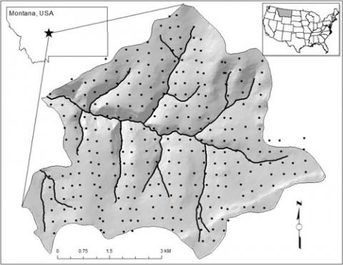
Monitoring wildland fuel characteristics on a 330 m grid across the entire TCEF.
Most ecological studies fail to account for ecosystem response and its variability over large space and long time scales. Impacts of many disturbances and management actions, such as climate change, mountain pine beetle outbreaks, timber harvesting, and wildland fire, must be studied across large areas to ensure the scale of the disturbance match the scale of analysis, and they must be studied for over long time periods to ensure all ecosystem responses are detected. The Tenderfoot Creek Experimental Forest (TCEF) Grid project was designed to establish a set of gridded plots across the TCEF to monitor changes in vegetation and fuel conditions. We permanently established tenth-acre fixed area plots on a 330-m grid across the Tenderfoot Creek Experimental Forest (TCEF) to monitor changes in vegetation and fuel dynamics over large spatial and temporal domains. This gridded network of plots allows scientists interested in studying lodgepole pine forests a unique resource of vegetation and fuel information re-measured after a 15-year interval over a large spatial extent.
