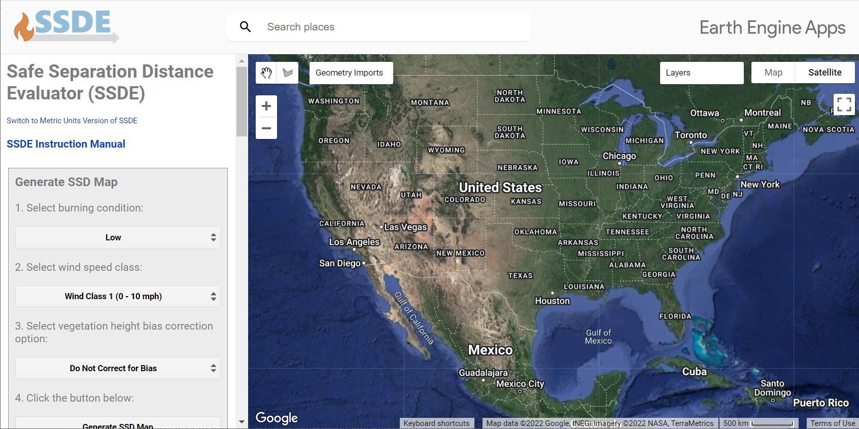
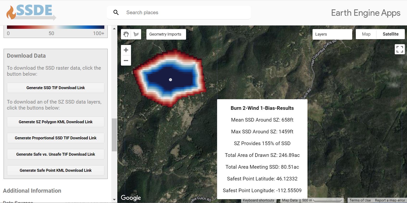
New research is focused on measuring and predicting the cumulative impact of convective and radiant energy transfer on safety zone size, shape, and location when the safety zone and/or fires are located on slopes or are burning under the influence of wind. Field measurements and a newly developed modeling tool (SSDE) are used to explore the expected range of slopes, safety zone locations and fire intensities. The SSDE tools calculates separation distance based on vegetation height, wind and slope adjustment factors and burning conditions. Fuels layers are imported for LANDFIRE Existing Vegetation Height. Slope is calculated from the Shuttle Radar Topography Mission (STRM) digital elevation model. Winds are derived from the local fire weather forecast. Burning conditions are based on fuel moisture, relative humidity, and temperature. The Safe Separation Distance Evaluator (SSDE) algorithm is built and applied in Google Earth Engine (GEE), a cloud-based platform for processing and analyzing GIS and remotely sensed data, using JavaScript application programming interface. SSDE integrates evolving science and large scale, high resolution georeferenced data to calculate landscape scale safe separation distance estimates. This tool represents years of research and development and accurately accounts for the dynamic fire environment regarding firefighter safety.
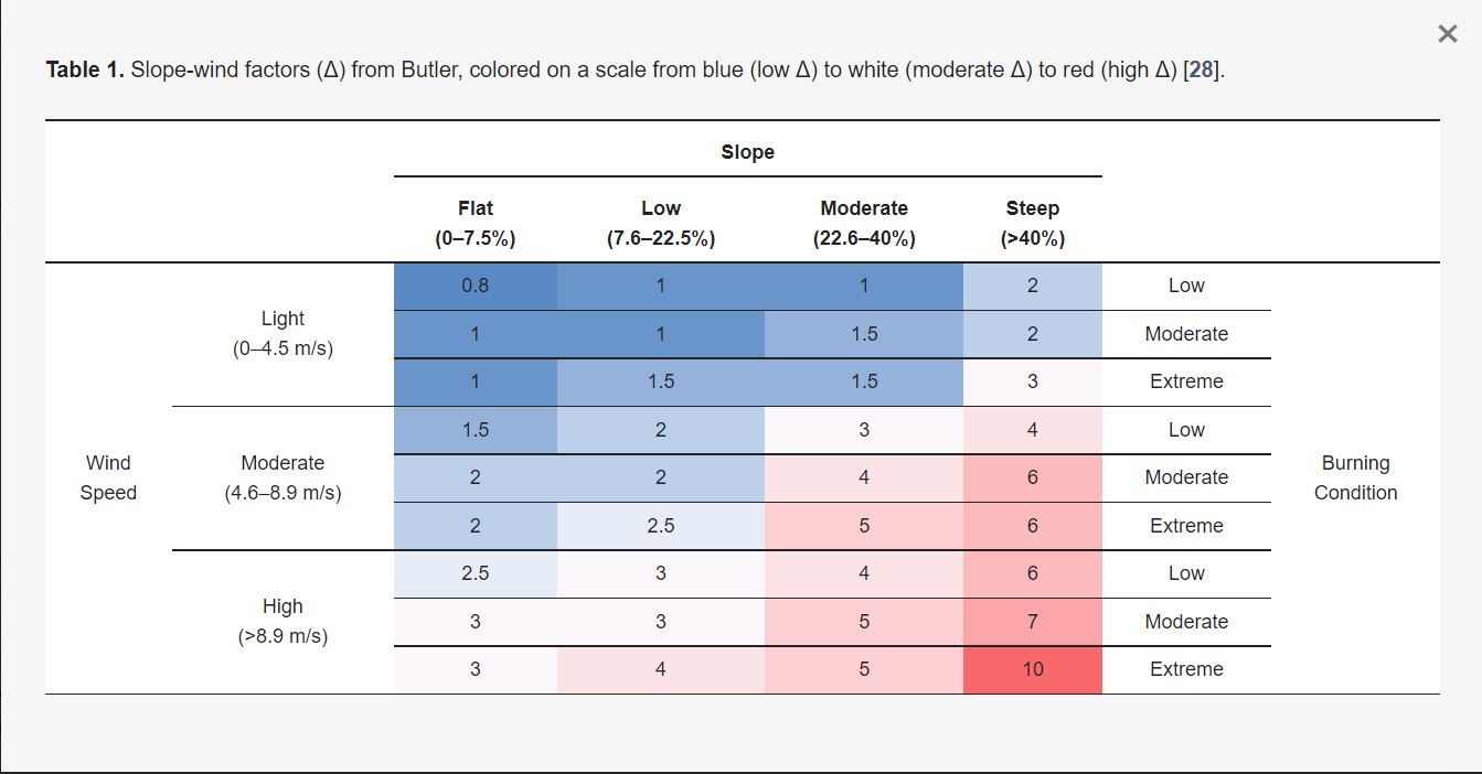
The SSDE tool uses an adaptive algorithm to calculate SSD. This algorithm is based on the standard safety zone calculation of 4 x vegetation height, but additionally accounts for local wind, slope and burning conditions (Δ).
SSD=8×VH×Δ
- SSD: Safe Separation Distance
- VH: Vegetation Height
- Δ: Wind Speed, Terrain Slope, Burning Condition factor
SSDE is designed to be used by fire professionals who possess some familiarity with GIS mapping technology and some knowledge of the principles and procedures of wildland firefighter safety.
We envision the SSDE being of broad interest to the wildland fire community, from fire scientists to incident management personnel to wildland firefighters. Its open-access nature allows anyone to explore, examine, and interact with the concepts of safety zones and SSD. Even if not used in an operational context, there is great value in being able to quickly and easily examine the conditions that define potential safety zone suitability on a broad spatial scale. Wildland firefighters designate safety zones daily as a part of their fire management duties. Built into this designation process is an inherent degree of subjectivity that can result in differences in the interpretation of safety zone suitability between and among crews. By using an objective tool for safety zone suitability analysis that can be broadly applied in the US, fire crews across the country can increase the consistency and reliability of the safety zone evaluation process.
Safety zones are fundamental tools that can be used by wildland firefighters to avoid injury or fatality when engaging in wildland fire operations. The National Wildfire Coordinating Group (NWCG) recommends that a safety zone be defined as a pre-planned area of sufficient size and suitable location that is expected to prevent injury to fire personnel from known hazards without using fire shelters. Effective safety zones provide safe separation distance (SSD) from surrounding flames, ensuring that the surrounding heat cannot cause burn injury. We introduce a new online tool for mapping SSD based on vegetation height, terrain, wind speed, and burning conditions: the Safe Separation Distance Evaluator (SSDE).