
The Display Results form has two functions: (1) conversion of a field in a shapefile to a raster with defined spatial reference; and (2) customized display of existing raster layer.

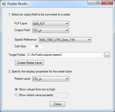
1. Select and output field to be converted to a raster, is used to convert any gridded point shapefile to a raster. This is most often used to convert values within a FLP. The user specifies the output cell size based on the shapefile point spacing, and the spatial reference.
2. Specify the display properties for the raster layer, will change the display properties for the newly created raster, or any other raster. There are two options for the display, the first is a ramp from high to low, the second is a two color scheme where all values are either above or below a specified value.

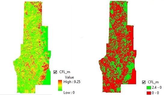
Conditional flame length (meters) from a converted 90 m raster, displayed from high to low (left) and for values exceeding 2.4 m (8 ft).
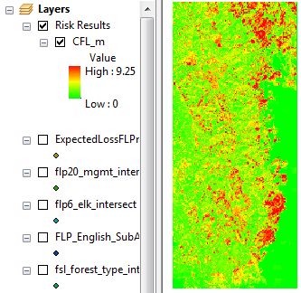
In this exercise a projected raster of conditional flame lengths will be created from a FLP file with 20 FIL categories. Once created the raster will displayed to show values from low to high.
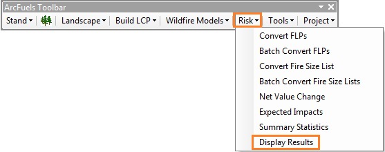
Click the Risk button on the ArcFuels10 toolbar, then select Display Results from the drop-down list.

Fill out the Display Results form following the figure below.
Leave the Display Results form open, and fill it out according to the figure below.

Return to ArcMap.

To continue to the next section go to Tools.